BNIA-JFI's Flow Baltimore Migration Analysis System
Methodological Overview
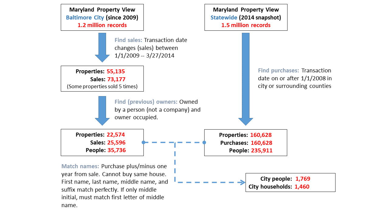
BNIA-JFI staff analyzed five years of MdProperty View records to match new residences for any Baltimore City resident-owners who sold their home between January 2009 and March 2014. Based on a qualifying sale in the database, the name of the seller and date of sale were checked against purchases in the city and four surrounding counties (Anne Arundel, Baltimore, Harford, and Howard). If a name matched and the purchase was within one year of the sale in the city, the linked records were identified as the origin and destination of a move. Matching was accomplished through SQL scripts in a PostGIS enabled PostgreSQL database.
This method identified 1,769 movers in 1,460 households1. As implemented here, the technique detects moves within Baltimore City and from Baltimore City to the surrounding counties. A major advantage of this approach is that it allows migration tracking down to the parcel level, providing a greater volume of migration data and more details about geographic patterns and housing characteristics than sources provided by the U.S. Census2. However, this method has inherent biases as well. Matches work best with individuals whose names are relatively unique and do not change after a move (from marriage or divorce for instance). The technique does not enable tracking of renter-occupants who may move even if the property owner does not change. The diagram below provides an overview of the approach.
1 For an analysis of matches, please see Grow Baltimore Brief #2: Migration Patterns by Community in the Baltimore Region, specifically the section "Migration Patterns of Homeowners in the Baltimore Region" starting on page 6.
2 The Census Flows Mapper provides county level flows and therefore see Baltimore City as a single geographic area. The current Public Use Micro Sample divides Baltimore City into only five geographic areas. In contrast BNIA-JFI divides the city into 55 community statistical areas.